


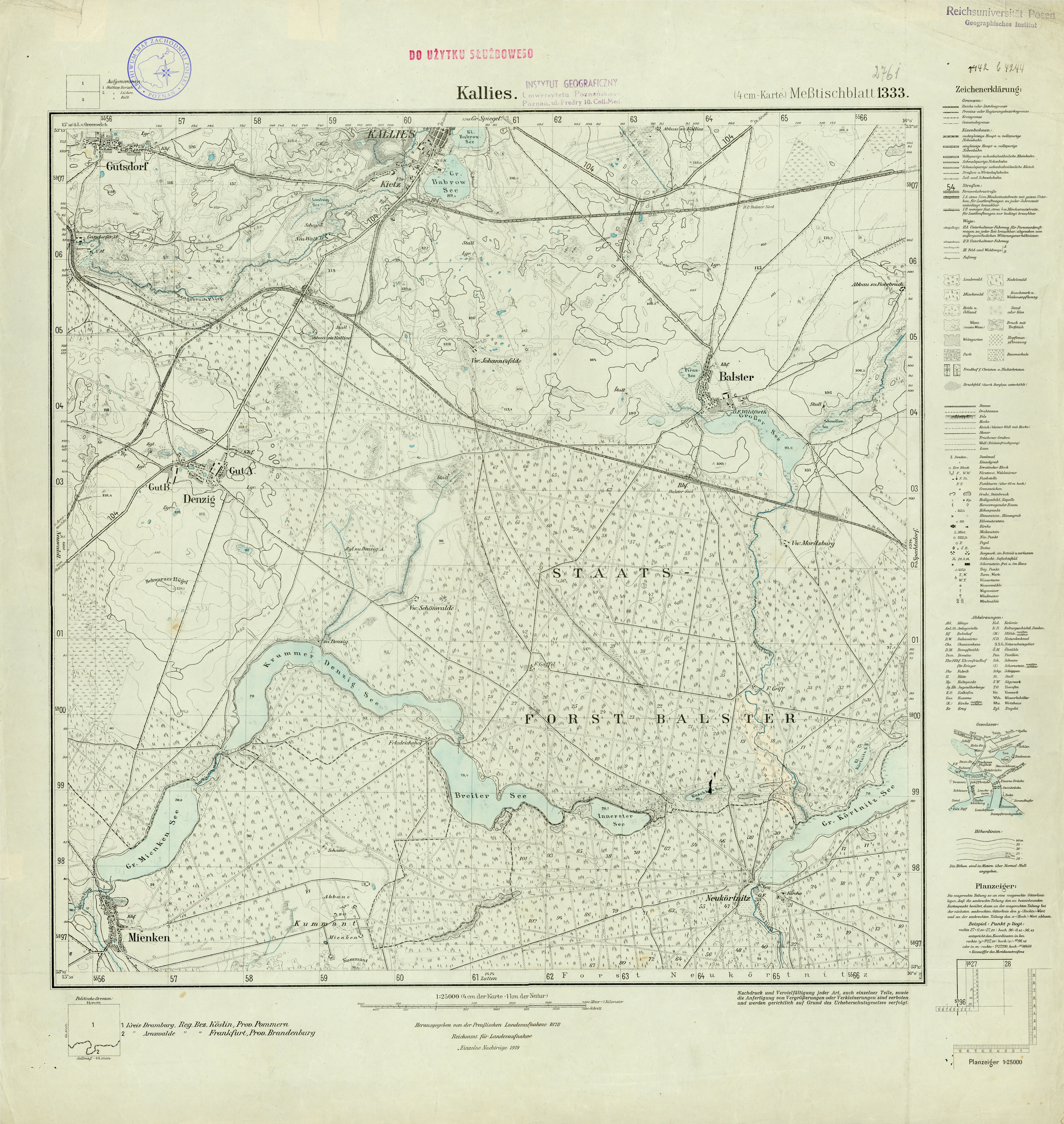
| map file | 2761_Kallies_1932.jpg |
|---|---|
| file size | 8896920 (8.5 MB) |
| sheet number | 2761 (1333) |
| sheet title | Kallies |
| modern name | Kalisz Pomorski |
| publication year | 1932 |
| scan resolution | 300 dpi |
| entry edited | 2012-07-20 08:30:59 |
| from the collection of | Archiwum Map Zachodniej Polski |
