


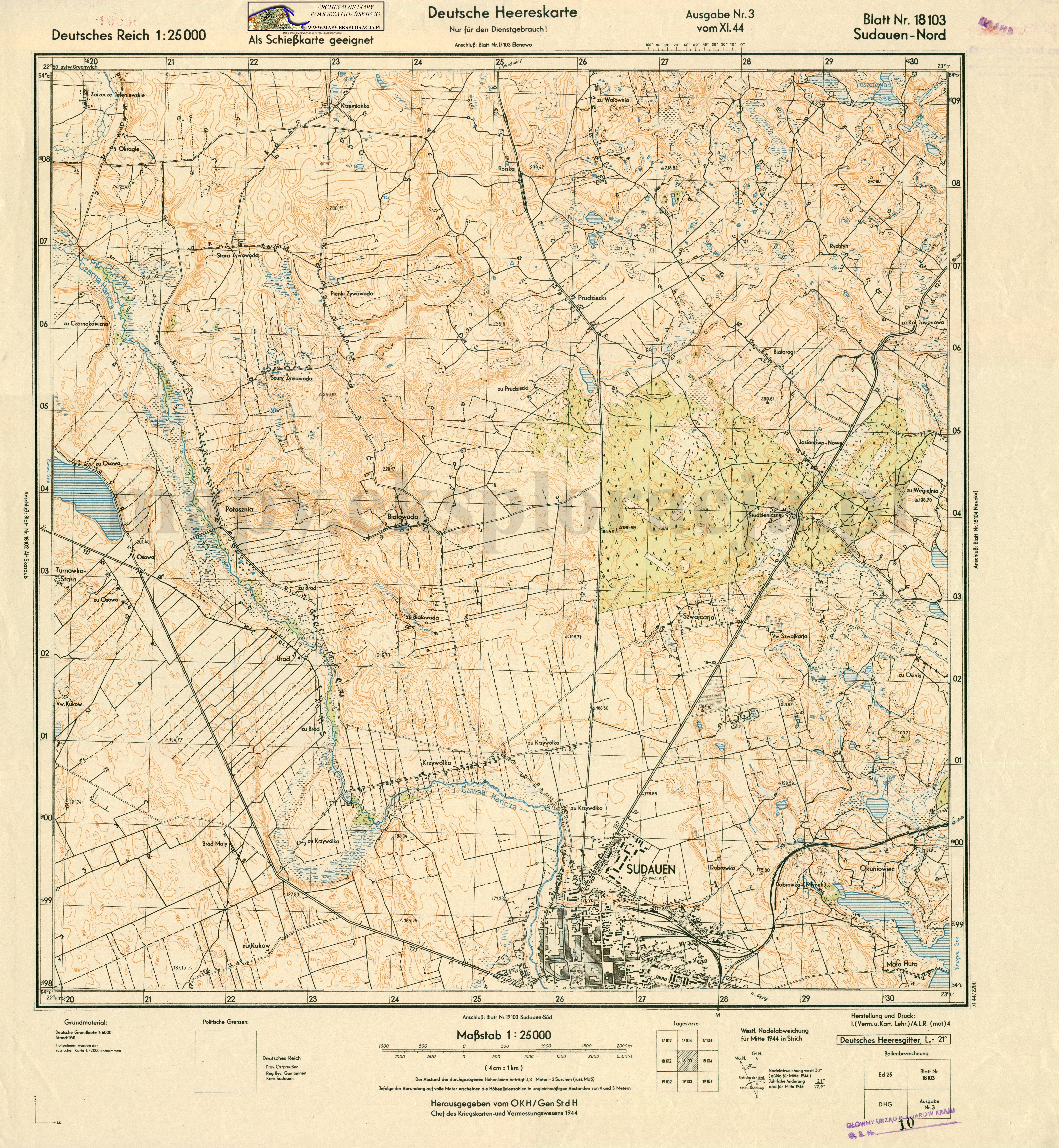
| map file | 18103_Sudauen_Nord_1944_400dpi_AMPG.jpg |
|---|---|
| file size | 7247570 (6.9 MB) |
| sheet number | 18103 |
| sheet title | Sudauen - Nord |
| modern name | Suwałki |
| alternative name | Suwalken, Sudauen (1940-45); Suvalkai; Сувалкі; סובאלק |
| publication year | 1944 |
| publisher | Reichsamt für Landesaufnahme |
| map type | Deutsche Heereskarte C |
| description | Military edition, type of the year 1944. With the kilometre-nominated GK grid of type DRG or DHG, zero meridian Greenwich. Sheet numbering system of the new type. A four-colour map (basic content in black, waters in blue, contours in brown, forests in green). |
| map/scan condition | good |
| scan resolution | 400 dpi |
| scan colors | rgb |
| entry edited | 2012-07-20 08:28:26 |
| from the collection of | Archiwum Map Pomorza Gdańskiego |
