


| map file | P50-S27-A_FRYDEK_1938.jpg |
|---|---|
| file size | 10807000 (10.3 MB) |
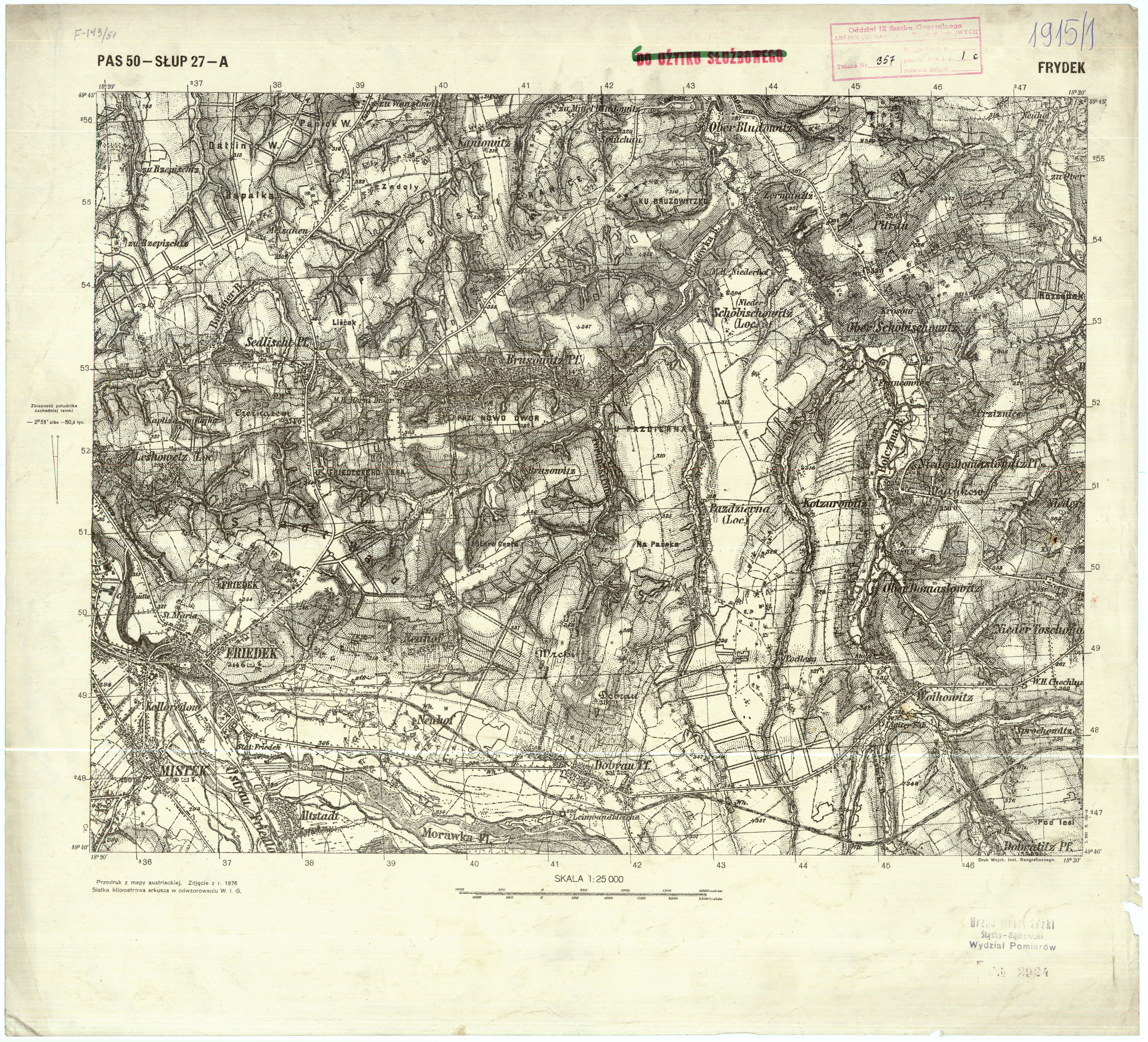
| sheet number | P50 S27 A (5027 A) |
| sheet title | FRYDEK |
| publication year | 1938 |
| publisher | Wojskowy Instytut Geograficzny |
| scan resolution | 400 dpi |
| entry edited | 2011-10-09 18:11:31 |
| from the collection of | Instytut Geografii Uniwersytetu Pedagogicznego w Krakowie |
