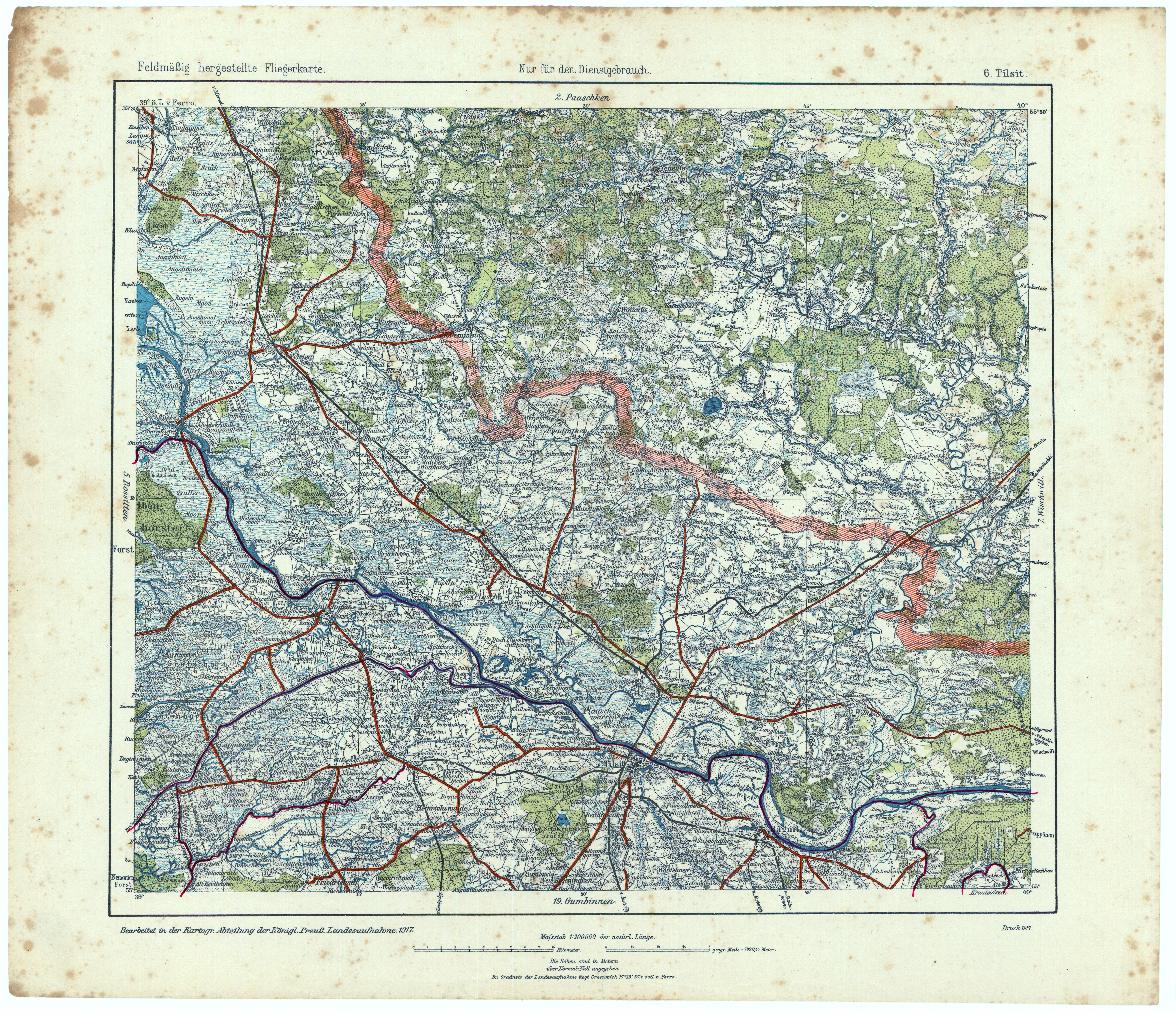
| map file | Topograph.Special-Karte_von_Mittel-Europa_6_Tilsit_Feldmaessige_Fliegerkarte_1917.jpg |
|---|
| file size | 8673200 (8.3 MB) |
|---|
| sheet number | 006 |
|---|
| map sheet scale | 1:200,000 |
|---|
| sheet title | Tilsit (Feldmäßig hergestellte Fliegerkarte) |
|---|
| modern name | Сове́тск |
|---|
| alternative name | Tilsit, Tilžė, Tylża |
|---|
| annotation | (Topograph. Special-Karte von Mittel-Europa) |
|---|
| publication year | 1917 |
|---|
| publisher | Kart. Abt. des stellv. Generalstabes der Armee |
|---|
| map/scan condition | bad |
|---|
| scan resolution | 400 dpi |
|---|
| scan colors | rgb |
|---|
| file added | 2022-06-04 |
|---|
| entry edited | 2022-06-04 15:09:17 |
|---|
| from the collection of | Archiwum Map WIG |
|---|


