


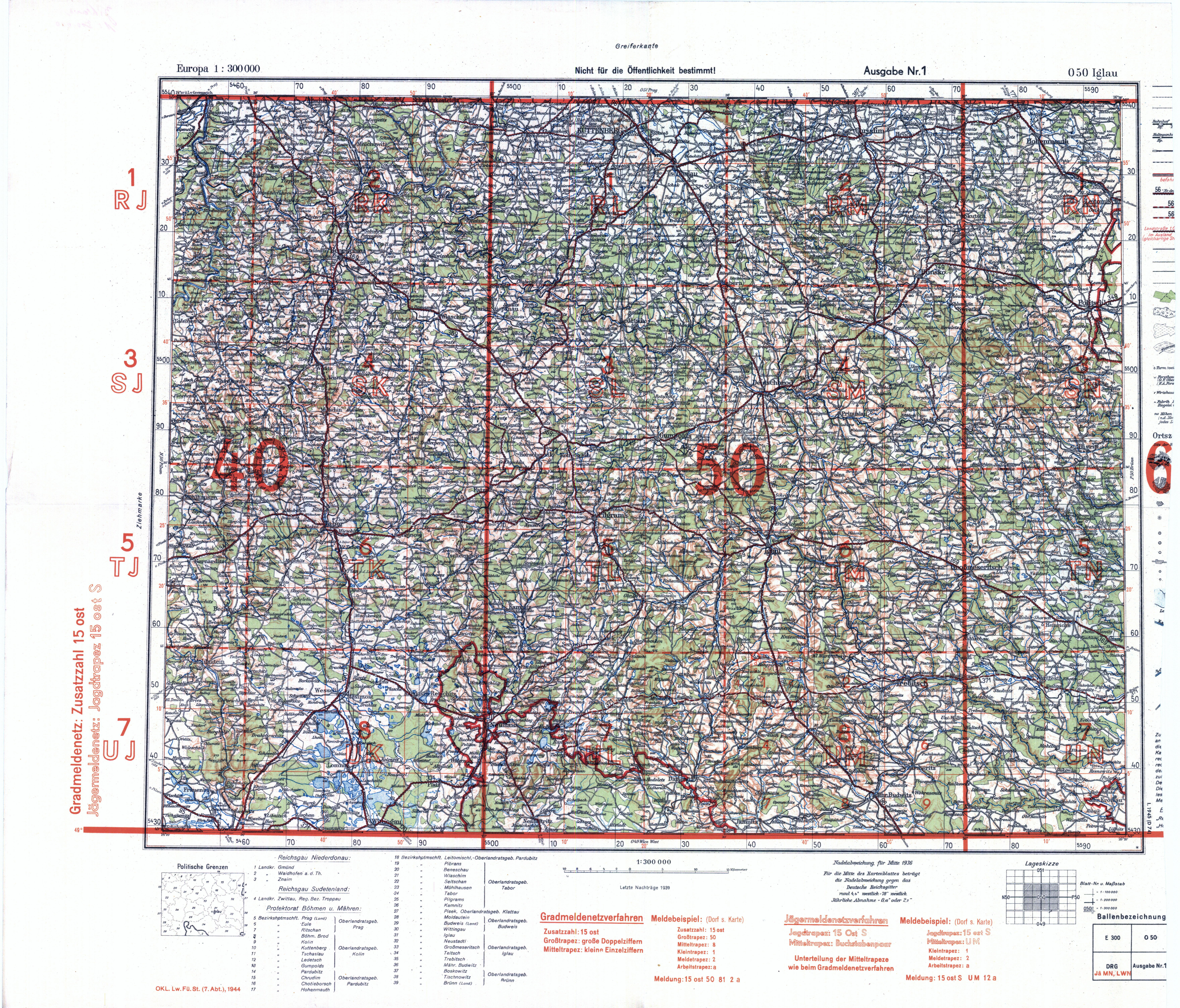
| map file | O50_Iglau_JaeMN_LWN_I.1945.jpg |
|---|---|
| file size | 10537040 (10.0 MB) |
| sheet number | O50 |
| sheet title | Iglau [LWN + JäMN] |
| modern name | Jihlava |
| publication year | 1945 |
| publisher | Oberkommando des Heeres / Generalstab |
| printer | D 45 : Kunstanstalten May AG, Dresden |
| map type | Deutsche Heereskarte |
| description | Military edition, type of the year 1941. With the GK grid each 10 kilometres, of type DHG or DRG, zero meridian Greenwich. Terrain profile shown by contours. The outline of built-over areas is provided for all localities except the smallest villages. A five-colour map (basic content in black, waters in blue, forests in green, main roads and built-over areas in orange, contours in brown). |
| map/scan condition | good |
| scan resolution | 300 dpi |
| scan colors | rgb |
| remarks | Europa 1:300 000, Ausg. 1 |
| file added | 2016-05-03 |
| entry edited | 2016-05-03 14:36:41 |
| from the collection of |
