


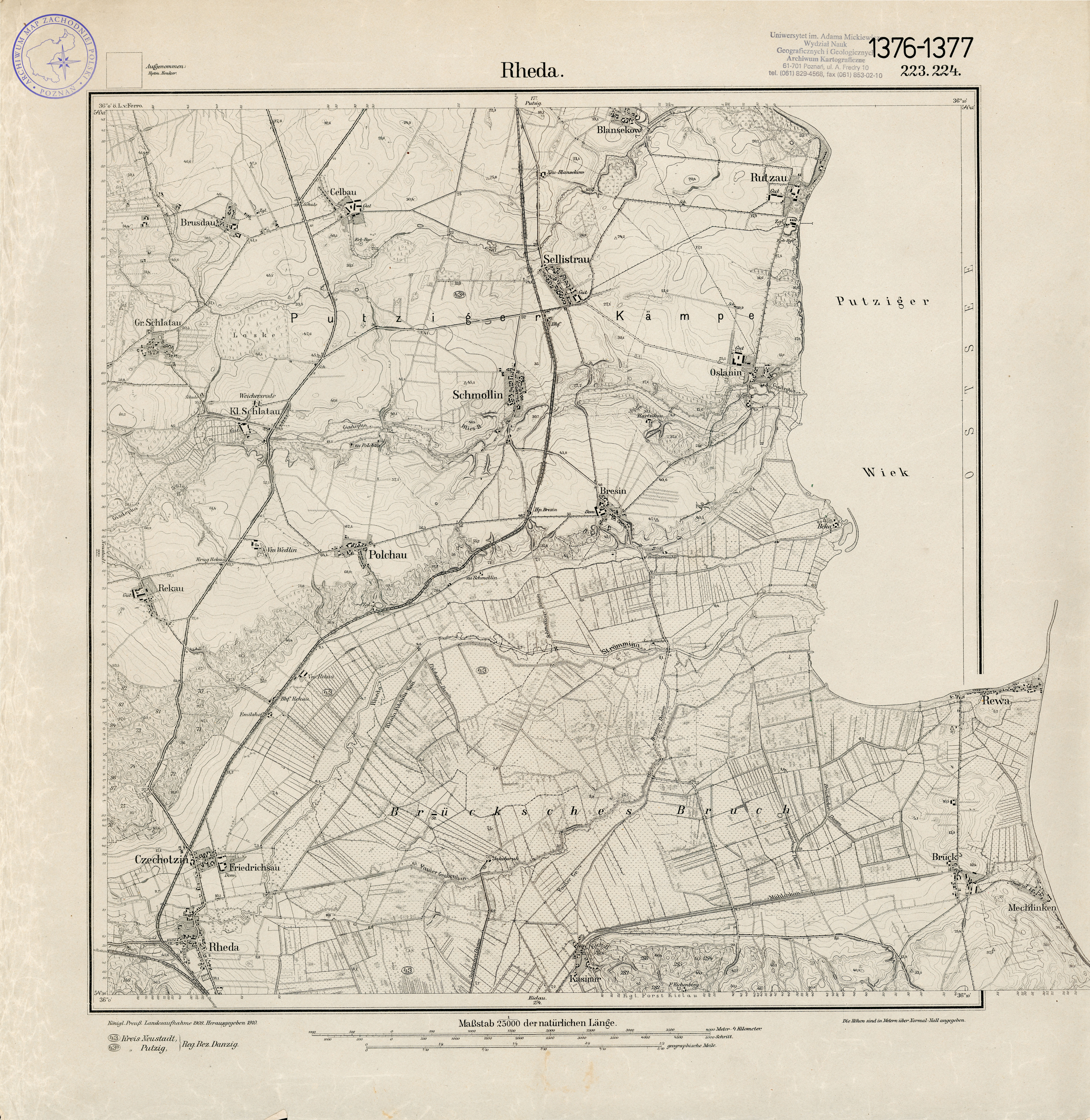
| map file | 1376_Rheda_1910.jpg |
|---|---|
| file size | 10337992 (9.9 MB) |
| sheet number | 1376 (223) |
| sheet title | Rheda |
| modern name | Reda |
| publication year | 1910 |
| publisher | Reichsamt für Landesaufnahme |
| scan resolution | 300 dpi |
| scan colors | rgb |
| file added | 2015-04-12 |
| entry edited | 2015-04-12 18:46:40 |
| from the collection of | Archiwum Map Zachodniej Polski |
