


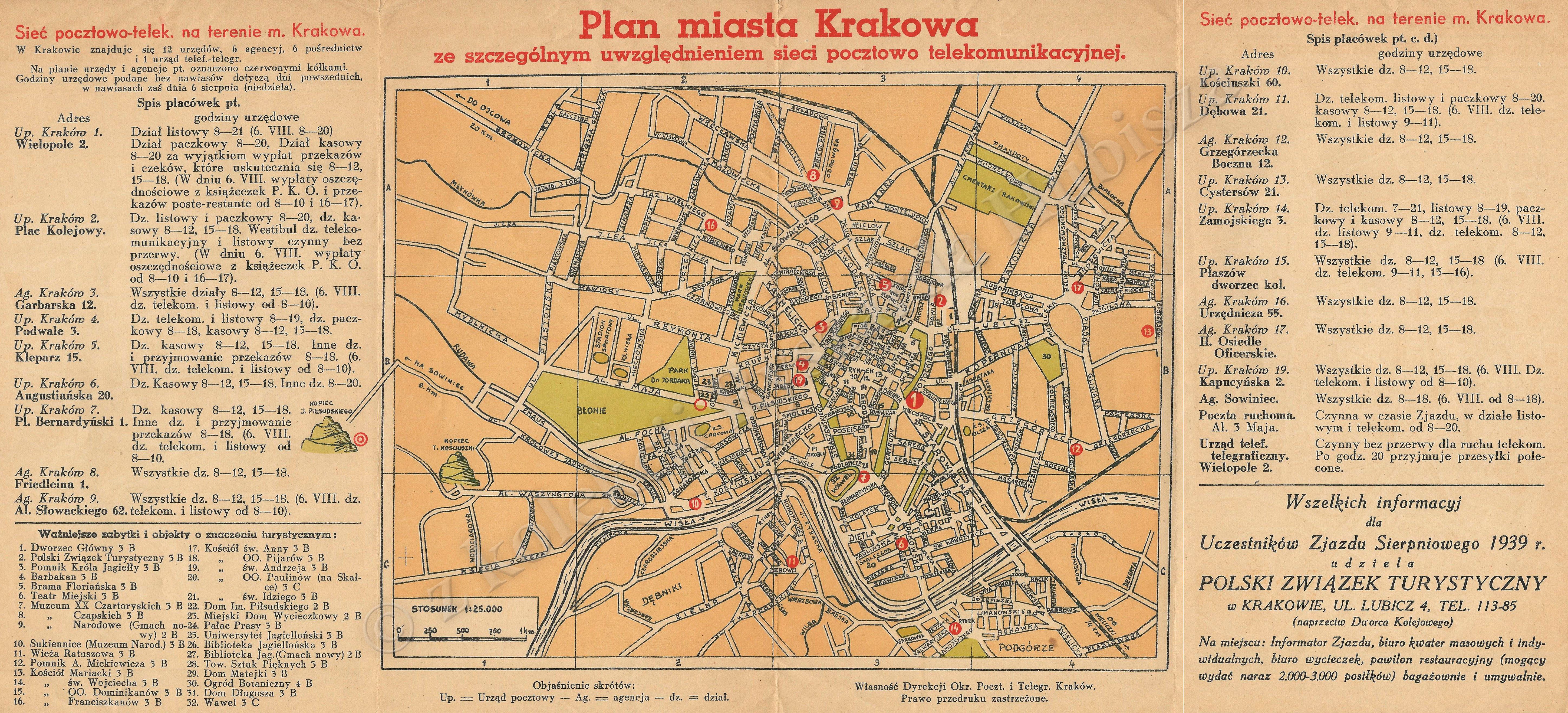
| map file | Plan_miasta_Krakowa_siec_pocztowo_telekom_25K.jpg |
|---|---|
| file size | 4274341 (4.1 MB) |
| sheet number | Kraków |
| map sheet scale | 1:25,000 |
| sheet title | Plan miasta Krakowa ze szczególnym uwzględnieniem sieci pocztowo telekomunikacyjnej |
| modern name | Kraków |
| publication year | ±1925 |
| map/scan condition | good |
| scan resolution | 300 dpi |
| scan colors | rgb |
| file added | 2014-11-20 |
| entry edited | 2014-11-20 15:18:43 |
| from the collection of | Ryszard Hubisz |
