


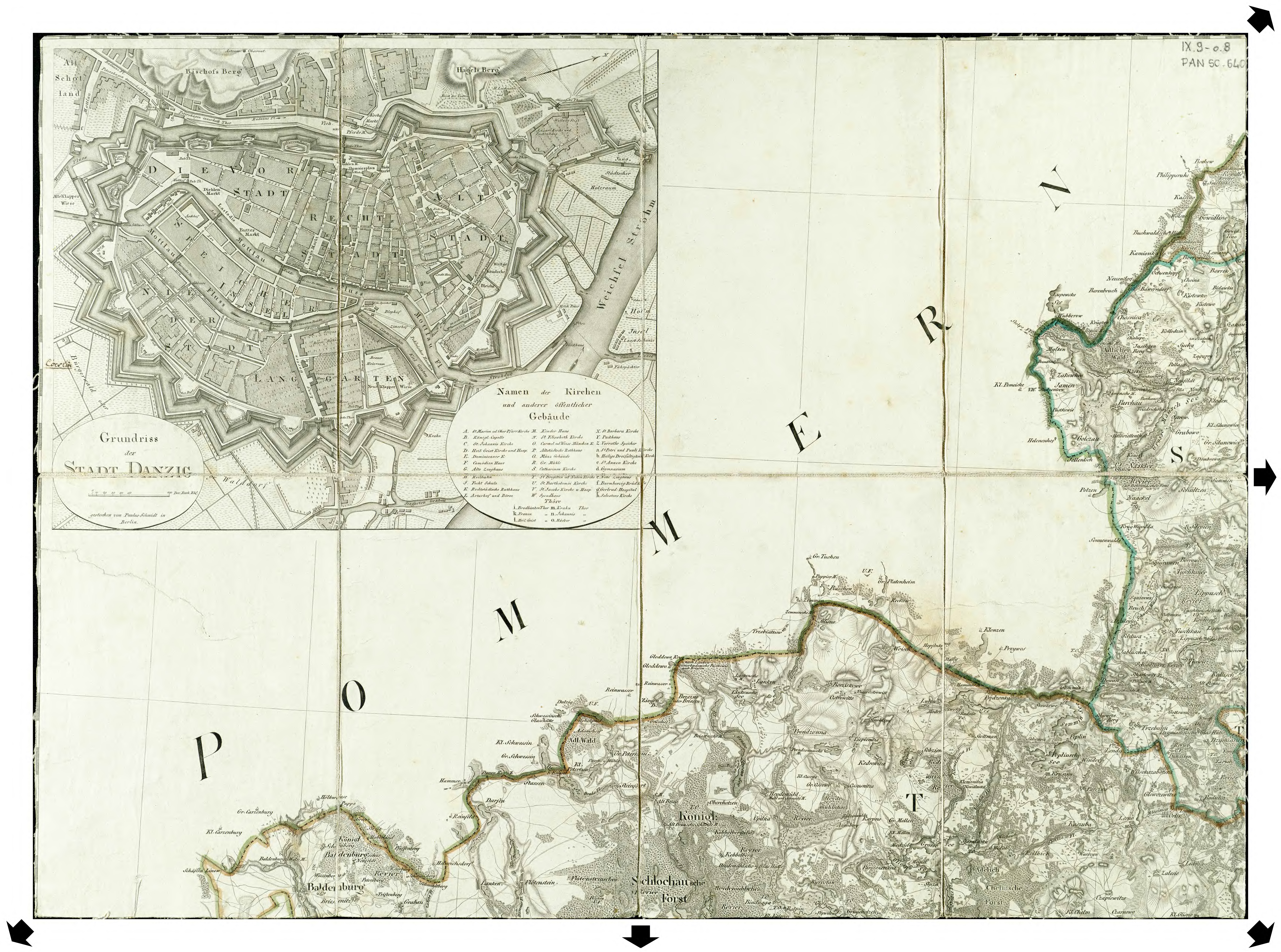
| map file | Schroetter-KvOWP_008_VIII_Baldenburg_PLAN_GDAŃSKA_1796-1802_RCIN_300.jpg |
|---|---|
| file size | 18746521 (17.9 MB) |
| sheet number | Gdańsk |
| sheet title | Danzig |
| modern name | Gdańsk |
| alternative name | Danzig |
| publication year | 1802 |
| map/scan condition | good |
| scan resolution | 300 dpi |
| scan colors | rgb |
| remarks | Plan zawarty w: / A plan included in: "Karte von Ost-Preussen nebst Preussisch Litthauen und West-Preussen nebst dem Netzdistrict aufgenommen unter Leitung des Königl. Preuss. Staats Ministers Frey Herrn von Schroetteer in den Jahren von 1796 bis 1802" |
| file added | 2014-08-31 |
| entry edited | 2014-08-31 16:29:45 |
| from the collection of | Repozytorium Cyfrowe Instytutów Naukowych |
| source reference | bc id: 829 |
