| map file | AKvdKGL_17_Umgebung_von_Bochnia_Woynicz_Limanowa_und_Zbyszyce_300dpi_jbc.jpg |
|---|
| file size | 21695023 (20.7 MB) |
|---|
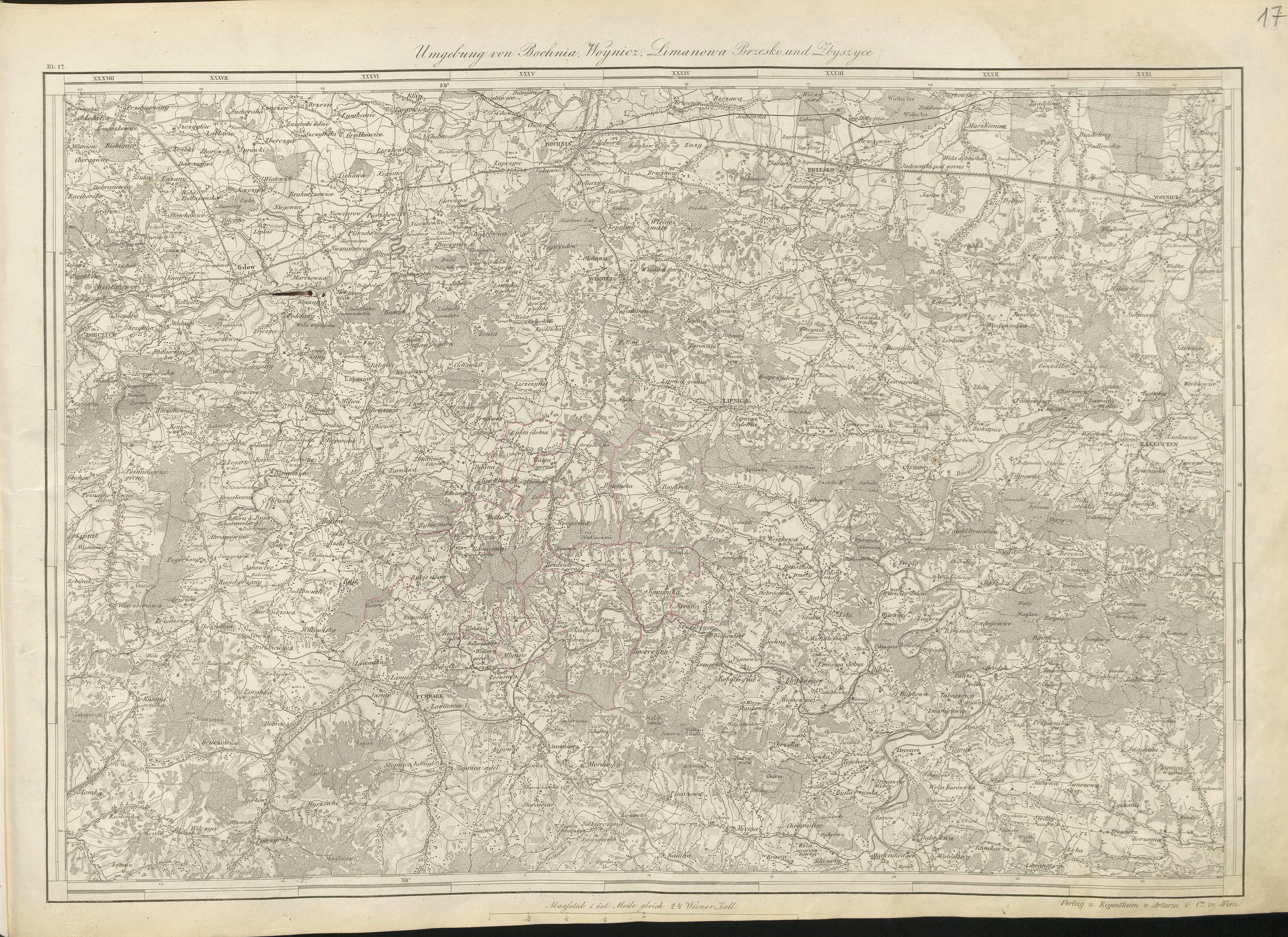
| sheet number | 17 |
|---|
| sheet title | Umgebing von Bochnia, Woynicz, Limanowa und Zbyszyce |
|---|
| modern name | Bochnia, Wojnicz, Myślenice, Jordanów |
|---|
| publication year | 1855 |
|---|
| map/scan condition | average |
|---|
| scan resolution | 300 dpi |
|---|
| remarks | "Administrativ Karte von den Königreichen Galizien und Lodomerien mit dem Grossherzogthume Krakau und den Herzogthümern Auschwitz, Zator und Bukowina in 60 Blättern, C.R. von Kummersberg" |
|---|
| file added | 2014-08-31 |
|---|
| entry edited | 2014-08-31 11:51:38 |
|---|
| from the collection of | Jagiellońska Biblioteka Cyfrowa |
|---|
| source reference | bc id: 230813 |
|---|


