


| map file | Schroetter-KvOWP_023_XXIII_Neidenburg_1796-1802_300dpi_RCIN.jpg |
|---|---|
| file size | 21913722 (20.9 MB) |
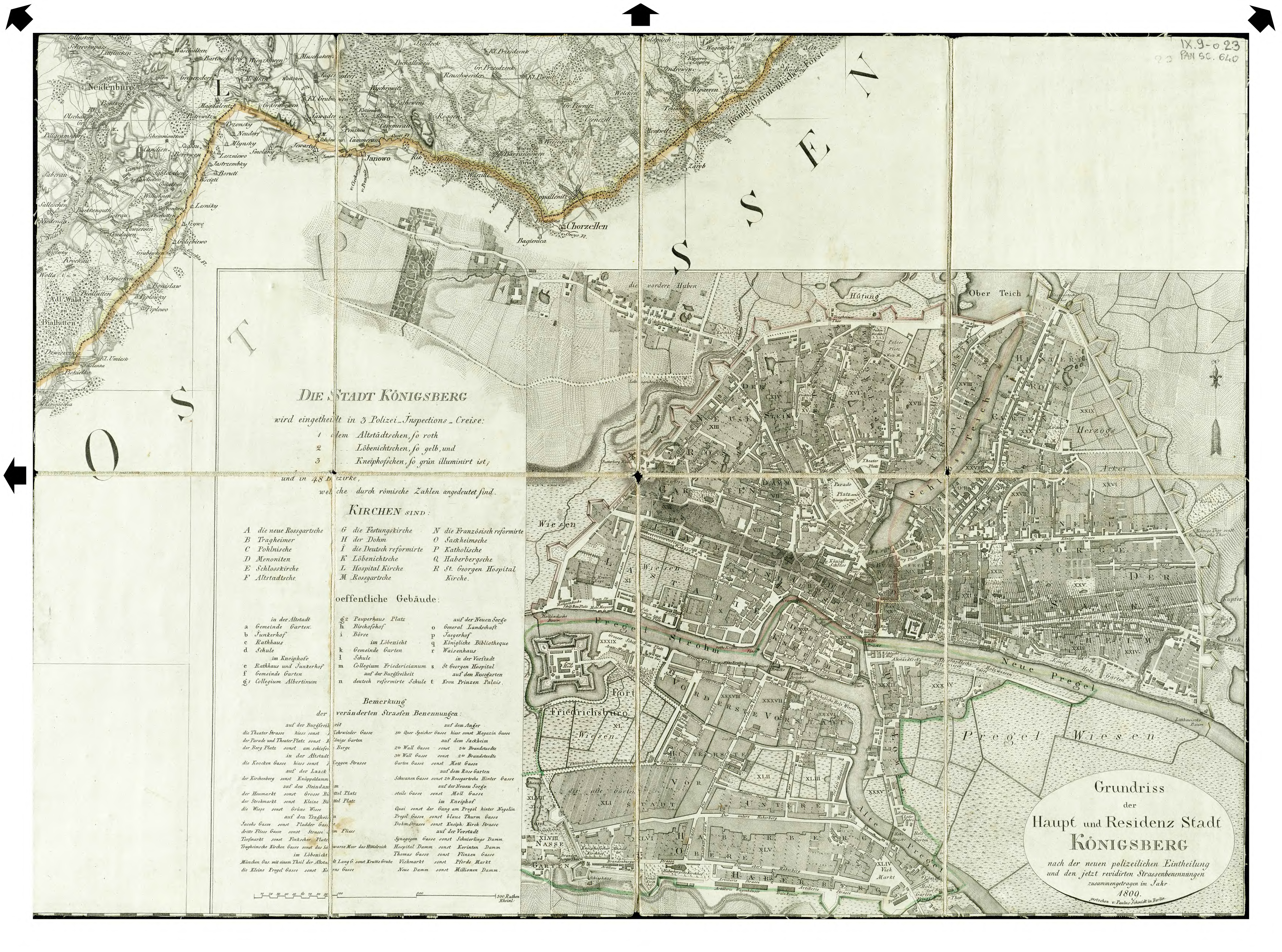
| sheet number | XXIII |
| sheet title | Neidenburg |
| modern name | Nidzica |
| publication year | 1802 |
| map/scan condition | average |
| scan resolution | 300 dpi |
| scan colors | rgb |
| remarks | Arkusz zawiera także plan Królewca A plan of Königsberg included in the sheet also. |
| file added | 2014-08-23 |
| entry edited | 2014-08-23 13:19:01 |
| from the collection of | Repozytorium Cyfrowe Instytutów Naukowych |
| source reference | bc id: 829 |
