


| map file | ssees0011_A_new_and_accurate_map_of_the_kingdom_of_Hungary-1752.jpg |
|---|---|
| file size | 6431097 (6.1 MB) |
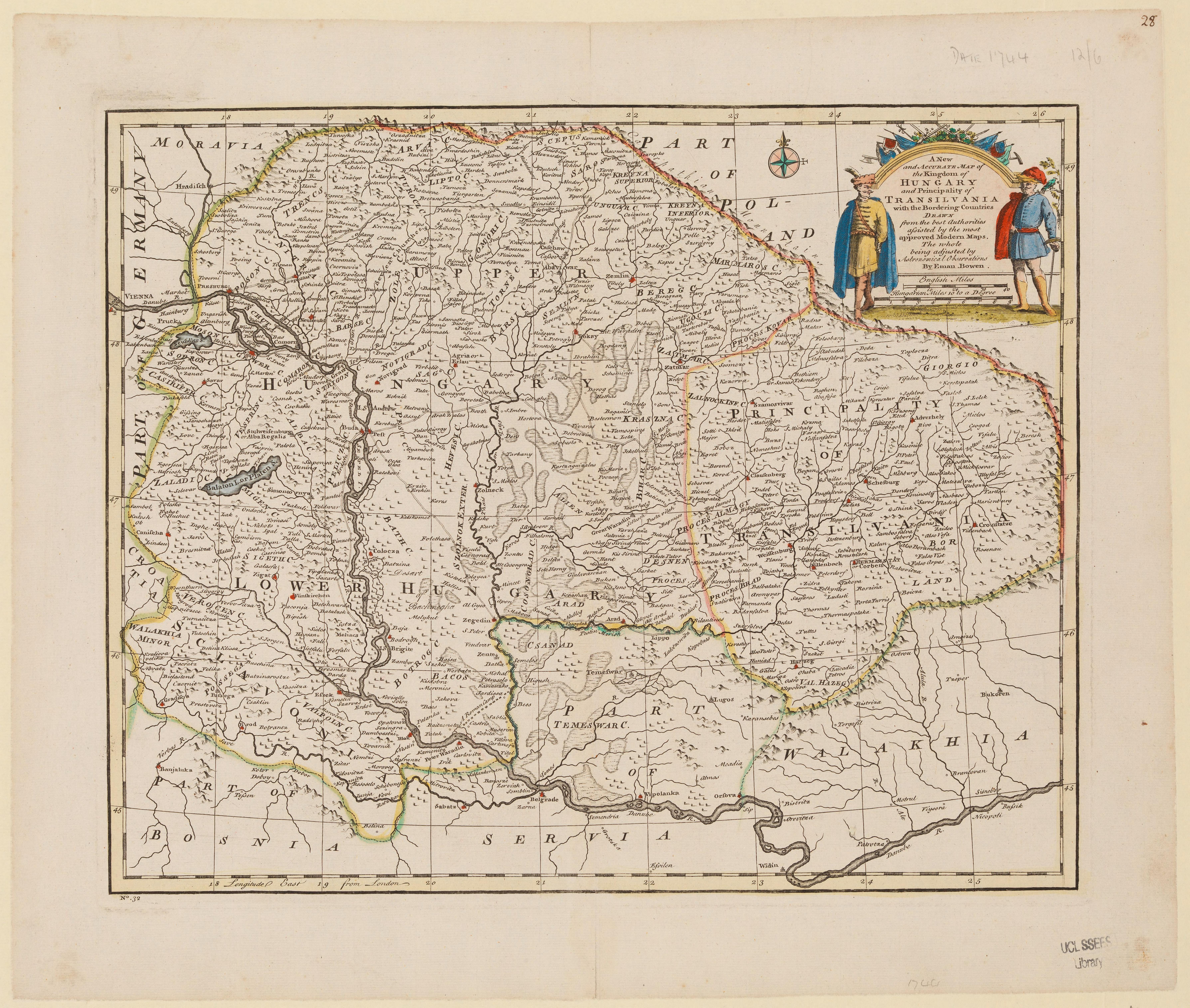
| sheet number | HUNGARY |
| sheet title | A new and accurate map of the kingdom of Hungary |
| publication year | 1752 |
| map/scan condition | good |
| scan resolution | 300 dpi |
| scan colors | rgb |
| remarks | A new and accurate map of the kingdom of Hungary and principality of Transilvania with the bordering countries :drawn from the best authorities assisted by the most approved modern maps : the whole being adjusted by astronomical observations /by Eman. Bow Bowen, Emanuel, d. 1767. From the collections of UCL SSEES Library [London] : Eman. Bowen , [1752] |
| file added | 2014-04-10 |
| entry edited | 2014-04-11 22:14:33 |
| from the collection of | University College of London, School of Slavonic and East European Studies |
| supplier's licence | Copyright UCL Library Services, 2010, licensed under Creative Commons Attribution-NonCommercial-ShareAlike 2.0 UK: England and Wales Licence. For further information on this Licence please refer to: http://creativecommons.org/licenses/by-nc-sa/2.0/uk/ |
