


| plik mapy | mappa_krolestwa_polskiego-006_woj_kaliskie_south_PBC_roteted.jpg |
|---|---|
| rozmiar pliku | 3184187 (3.0 MB) |
| godło arkusza | WKL |
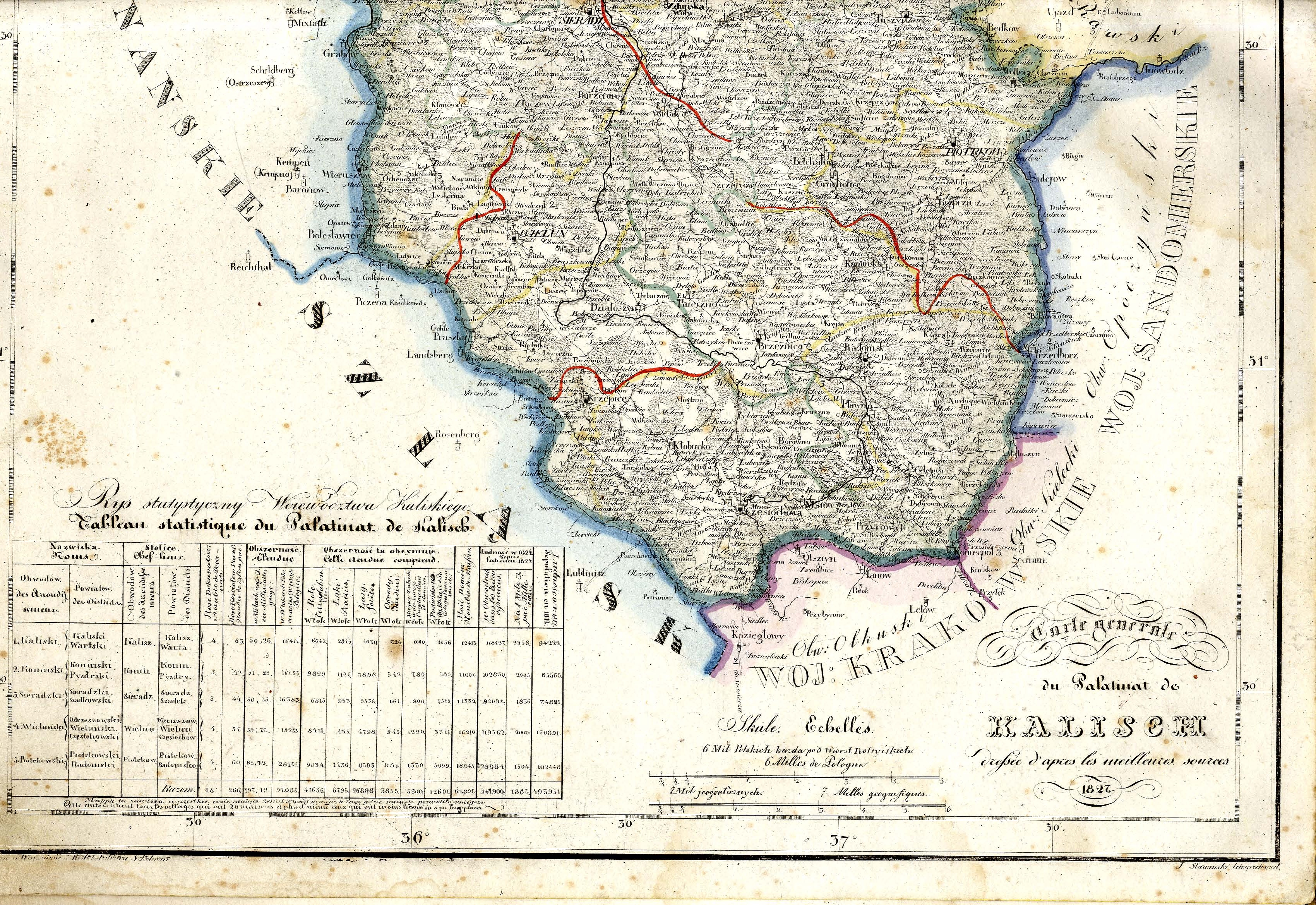
| tytuł arkusza | Mappa jeneralna województwa kaliskiego ułożona według naylepszych źródeł przez Juliusza Colberg 1827 --- część południowa, obrócona do naturalnego położenia |
| nazwa współczesna | A general map of the Voivodship of Kalisz compiled from best authorities by Julisz Colberg --- southern part, rotated to its natural position |
| adnotacja | Juliusz Colberg, Mappa Królestwa Polskiego |
| rozdzielczość | 300 dpi |
| plik dodano | 2013-06-22 |
| wpis edytowano | 2013-06-22 23:39:52 |
| ze zbiorów | Podlaska Biblioteka Cyfrowa |
