


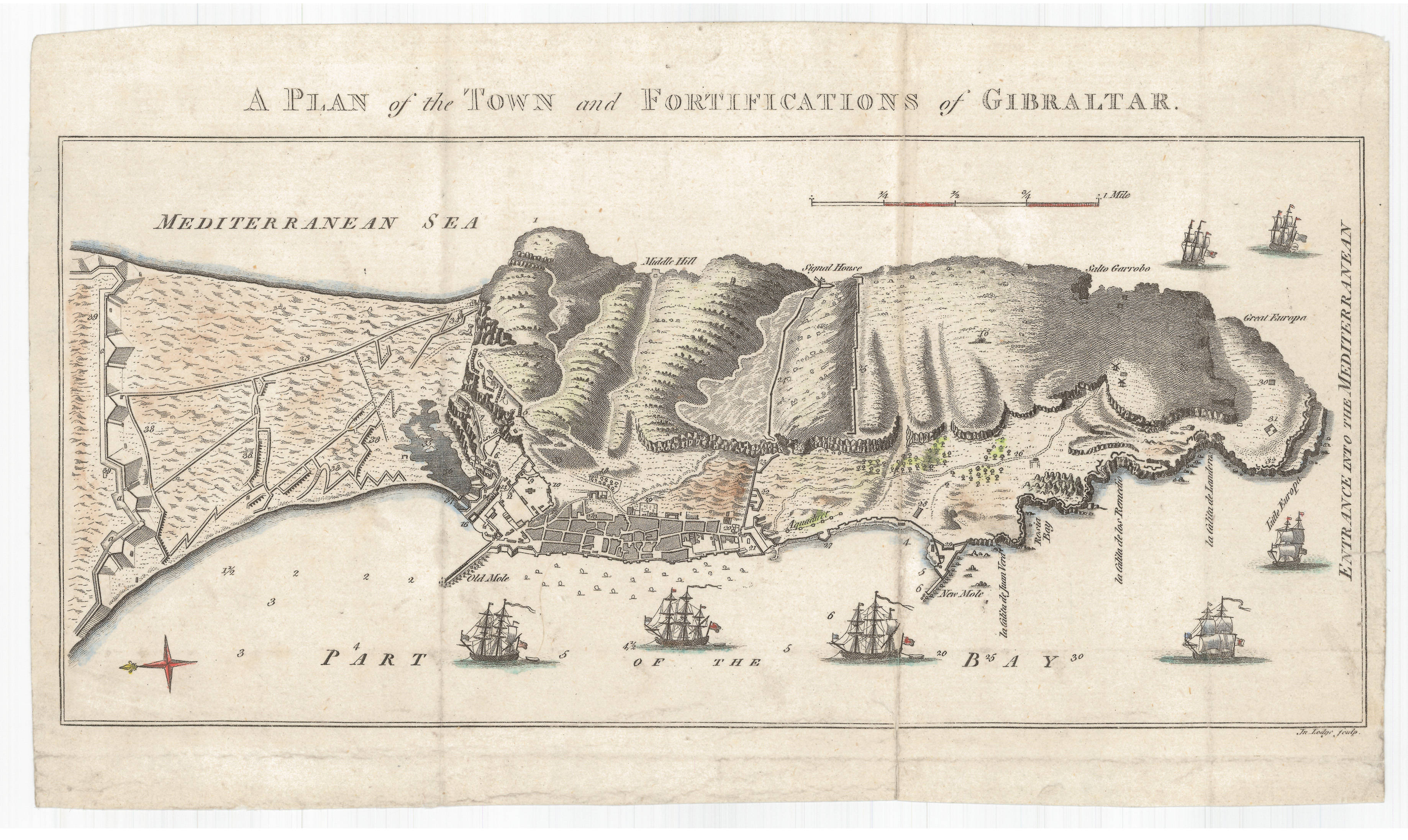
| plik mapy | A_PLAN_of_the_TOWN_and_FORTIFICATIONS_of_GIBRALTAR_1780_RM.143011.jpg |
|---|---|
| rozmiar pliku | 1452267 (1.4 MB) |
| godło arkusza | Eur-Iberian |
| tytuł arkusza | A PLAN of the TOWN and FORTIFICATIONS of GIBRALTAR |
| rok wydania | 1780 |
| stan mapy/skanu | dobry |
| rozdzielczość | 300 dpi |
| kolory skanu | rgb |
| plik dodano | 2020-09-12 |
| wpis edytowano | 2020-09-12 18:47:41 |
| ze zbiorów | Institut Cartogràfic de Catalunya |
| sygnatura | RM.143011 |
